I am currently enrolled in the Master of Geomatics for Environmental Management program at the University of British Columbia and as part of the program I have developed some GIS-related skills and competencies using some of the most recent and cutting-edge technological software. Some of these include ArcGIS, ArcPRO, QGIS, ENVI, Python, R, FUSION, Modelbuilder and a host of others. Outlined on this page are images and maps that I created, highlighting some of the in-class and personal projects I have worked on in the past year.
PROJECT 1
SUITABILITY HABITAT FOR LEPUS MILLIPEDIS IN SQUAMISH, BRITISH COLUMBIAEver Imagined what the perfect mammal would look like? An environmentally-friendly mammal that improves forest stand conditions, reduces erosion, improves wildlife habitat and that ultimately affects the economy positively. Sounds like a wild imagination right?
Yes! That is exactly what the Lepus Millipedis is expected to be. |

However, a necessary step if the production of the Lepus Millipedis will be successful is to find a suitable habitat that supports the species optimally.
That is exactly what this project is about. |
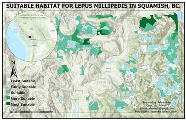
More details here... |
PROJECT 2
THE ANNUAL RATE OF MANGROVE DEFORESTATION IN AMBARO-AMBANJA BAY, MADAGASCAR.From the deserts of Africa to the rainforest of the Amazon, deforestation is a global problem. One that has depleted forest reserves, sent many animals and plant species into extinction, and further exposed mother earth to the harshness of global warming. This is a time lapse animation showing the rate of mangrove deforestation in Ambaro-Ambanja bay, Madagascar. More details here...
|
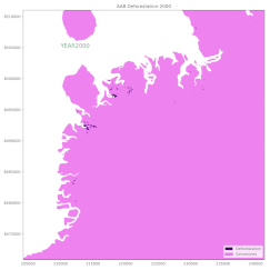
|
PROJECT 3
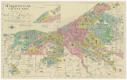
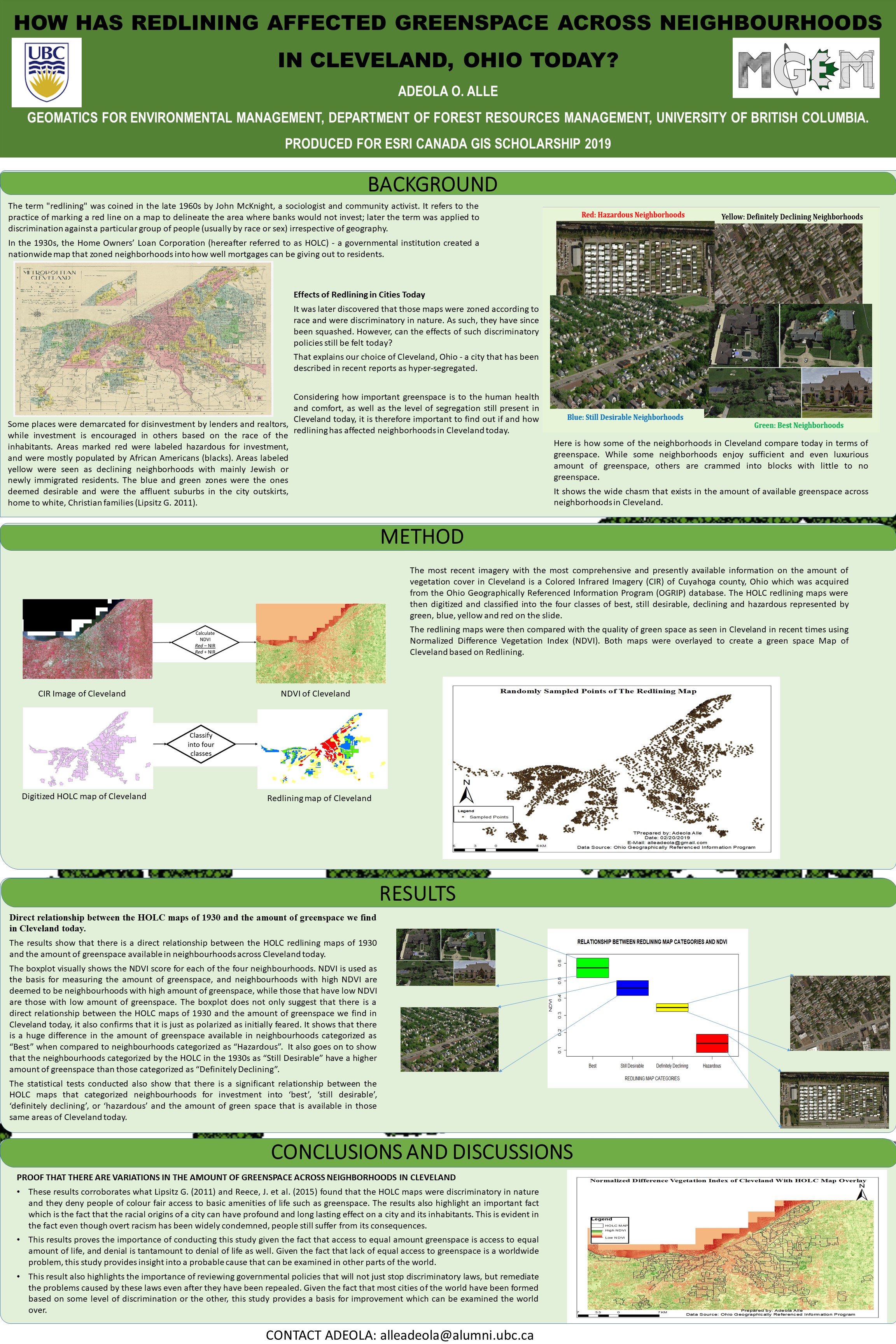
HOW DOES THE 1930 HOME OWNERS’ LOAN CORPORATION MAPS IN THE UNITED STATES OF AMERICA AFFECT GREEN SPACE IN CLEVELAND, OHIO TODAYIn the 1930s, the Home Owners’ Loan Corporation (hereafter referred to as HOLC) - a governmental institution created a nationwide map that zoned neighborhoods into how well mortgages can be giving out to residents. Poor people, most especially people of color were the biggest casualties of this segregation entrenching policy because they were zoned into neighborhoods categorized as hazardous. Although this discriminatory policy has been squashed a long time ago, people in these neighborhoods still suffer from it's effects. How?
Here is a poster explaining how.. |
|
